
 Indochina destination specialist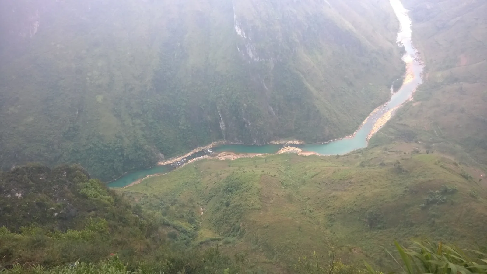
Tours · Vietnam
Ten days in the north, four of them on foot
A walking route through the limestone plateau above Ha Giang and down to the lake country at Ba Be. Four real walking days, five nights in village homestays and small guesthouses, and no coach park anywhere on the itinerary.
At a glance
- Length
- 10 days, 9 nights
- Group
- 4 – 10, or private from 2
- Start
- Hanoi
- End
- Hanoi
- Effort
- Moderate; 4 walking days, 8 – 16 km
- From
- USD 2,150 per person
The route
Who this is for
This route is for people who would rather walk into a village than be driven past it, and who accept that the price of that is sleeping on a mattress on a shared wooden floor for five of the nine nights. The walking is the trip. If the walking days were removed there would be a very long drive and not much else.
You need to be able to manage 8 to 16 kilometres in a day on uneven ground, with 400 to 700 metres of ascent, four days out of ten, on consecutive days twice. That is a level of fitness most people who walk regularly at home already have. It is not a technical route, there is no scrambling and no exposure that needs hands, but there is a great deal of loose limestone, and in the wet season the clay sections of the Du Gia descent are genuinely slippery.
The other thing this route asks for is patience with roads. Ha Giang is 320 kilometres from Hanoi and the mountain sections run at 30 to 40 kilometres an hour. Three of the ten days have five hours or more in the vehicle. We have spread them as far apart as the geography allows, and we do not pretend they are scenic driving the whole way.
What the walking is actually like
The four walking days sit between 900 and 1,600 metres. That is high enough to change the weather but not high enough for altitude to be a factor, so the effect you feel is temperature rather than thin air: 12 degrees at dawn on the plateau in November, 30 degrees on the valley floor at Du Gia the same afternoon.
A family house, usually with one large upstairs room. You sleep on a mattress on the floor under a mosquito net, alongside the rest of the group, separated by curtains rather than walls. The bathroom is shared and outside the sleeping room; three of the five have hot water from a solar tank, which means a warm shower at six in the evening and a cold one at six in the morning. There is electricity and a single shared power strip. There is no lock on the door of the room. We say all of this before you book because it is the most common reason someone tells us afterwards that the trip was not what they pictured.
Day by day
Day 1
Arrive Hanoi
Met at Noi Bai and driven the 35 kilometres into the old quarter, which takes 50 minutes outside rush hour. Nothing is scheduled. If you arrive before midday, the guide will meet you at 17:00 for a kit check: boots, waterproof, head torch, and the two litres of water capacity you will want from day four.
Day 2
Hanoi to Ha Giang
Away at 07:30 to clear the city before the school traffic. The first 150 kilometres are expressway; after Tuyen Quang the road narrows and slows, and the whole run takes about six and a half hours including a lunch stop at Vinh Tuy.
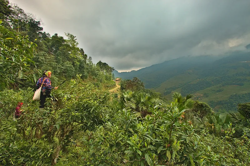
We break the sitting with a 45-minute leg-stretch on the tea terraces above Bac Quang in the late afternoon. Ha Giang town is a working border town rather than a destination, and the point of the night here is that it puts the plateau within reach in the morning.
Day 3
Up to the Dong Van plateau
The climb starts immediately. Quan Ba at 1,050 metres by mid-morning, then the long traverse through Yen Minh with its pine belt, and into Dong Van by late afternoon. Five and a half hours of driving, but almost none of it straight.
Two stops that are worth the time: the hemp weavers at Lung Tam, where the indigo vats are behind the workshop and you can see what four months of work on one length of cloth looks like, and a 4-kilometre walk down through Sa Phin to the vehicle.
Day 4
First walking day, Dong Van to Ma Le
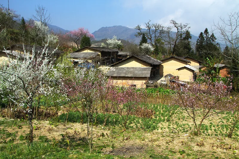
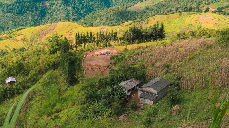
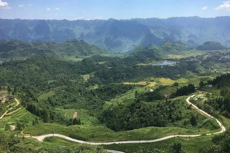
The last hour on the ridge, when the stone fields below turn the colour of the sky and you can see three valleys at once
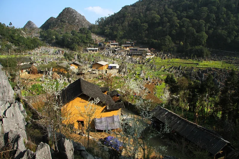
Out of Dong Van on foot at 08:00, north across the stone fields towards the border ridge. Fourteen kilometres and about 600 metres of ascent, taken in two climbs with the maize terraces between them. This is the day that tells you what the rest of the walking will be: there is no soil here worth the name, and every field you cross has been built by hand out of the gaps between limestone teeth.
Lunch is carried and eaten on the ridge, usually around 12:30. We reach Ma Le between 15:30 and 16:30 depending on how long the group stops. The homestay is a Hmong family house with the upstairs room described above, and dinner is cooked in the kitchen you walk through to get to it.
Day 5
Second walking day, and the Ma Pi Leng pass
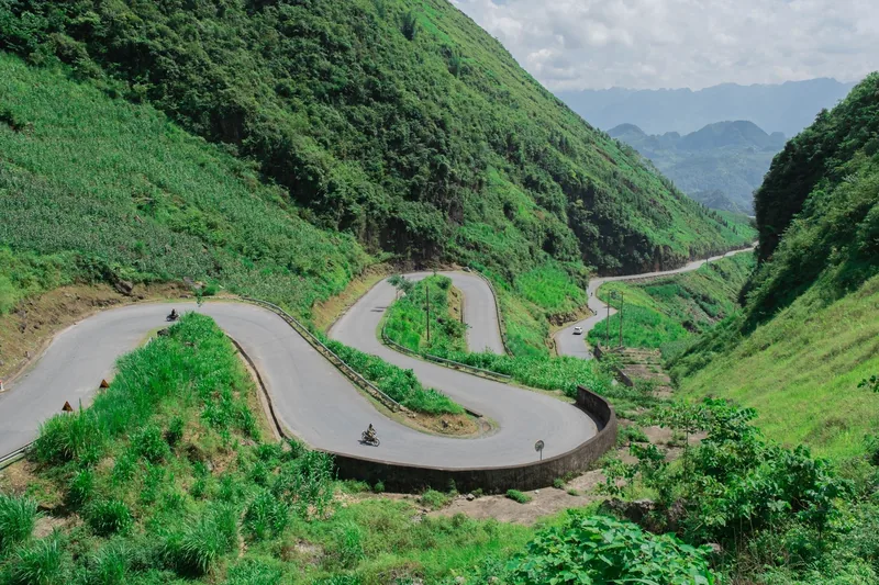
Standing on the pass road late enough that the tour vans have gone and the river noise comes up the canyon
A shorter day on foot: 11 kilometres south-east off the plateau edge, 200 metres up and 550 down, finishing at the road by 13:00. The descent is the first properly slippery ground of the trip, and in June or July we allow an extra hour for it.
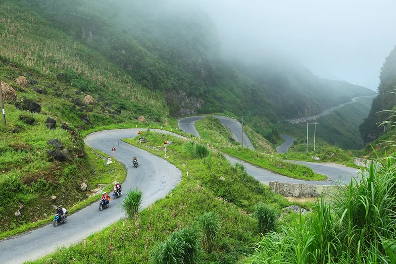
The vehicle takes the Ma Pi Leng pass in the middle of the afternoon. The road was cut by hand between 1959 and 1965 and runs 800 metres above the Nho Que river; we stop twice on the way over, once at the viewpoint everyone stops at and once at a bend three kilometres further on where nobody does. Meo Vac by 17:00.
Day 6
Meo Vac to the Du Gia valley
A three-hour transfer south on a road that was resurfaced in 2022 and is now merely narrow rather than broken. We arrive at Du Gia in time for lunch at the homestay.
The afternoon is a 9-kilometre loop along the river and up to the waterfall, flat for the first hour and then a short steep section on tree roots. Most people swim. This is the easiest of the four walking days and it exists partly to let the legs recover from day four.
Day 7
Third walking day, the Du Gia ridge
The longest day: 16 kilometres over the ridge behind the village and down into the next valley, with 700 metres of ascent in the first two hours. We leave at 07:00 to get the climb done before the heat, which in April means starting in the dark for twenty minutes.
There is no road contact between hour one and hour six. If somebody is going to find the walking harder than expected, this is the day it shows, and it is why we ask honest questions about fitness at the booking stage rather than at the trailhead.
Back at the homestay by 16:30. Second night in the same house, same room, and the second night is usually the one people remember, because by then you know which child belongs to which adult.
Day 8
Du Gia to Ba Be lake
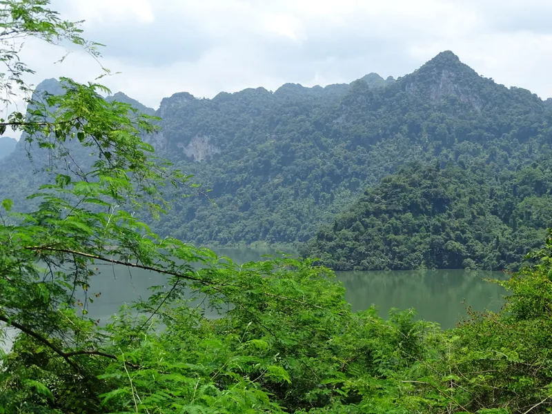
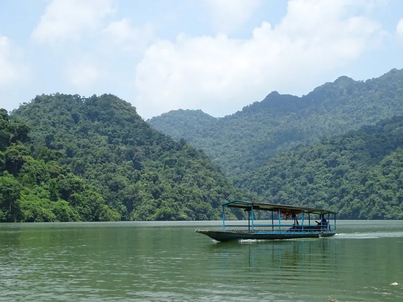
Crossing the lake at the end of a driving day, which is a better arrival than any hotel lobby
The long transfer of the trip: six and a half hours east and south, 240 kilometres, through Bac Me and Na Hang. Two proper stops and a lunch. We do not dress this up — it is a driving day, and we run it after the hardest walking day for exactly that reason.
At the lake, the boat takes 40 minutes from the jetty to Pac Ngoi village, and we arrive with enough light to see the limestone walls on the far shore. The stilt house here is a step up from the Ha Giang homestays: private rooms with a wooden partition to the ceiling, and a bathroom shared between two rooms.
Day 9
Fourth walking day, Ba Be
A boat at 08:00 up the Nang river, through the Puong cave where the river runs under 300 metres of limestone and the bat colony lives in the roof, and out at Hua Ma.
The walk is 10 kilometres through forest and hill fields on the eastern side of the lake, with 350 metres of ascent and one exposed section along a cut ledge above the water. Different ground from Ha Giang entirely: wet, green, and under canopy for most of it. The boat picks the group up at 16:00.
Day 10
Ba Be to Hanoi, and out
Away at 08:00 for the 230-kilometre run to Hanoi, which takes about six hours with one stop. We drop at the airport or in the old quarter, as you prefer. For an international flight out the same evening we ask you to be on a departure after 19:00; anything earlier and we will put you in Hanoi the night before instead.
What it costs
| Party size | Per person | Single room supplement |
|---|---|---|
| 2 travellers, private | USD 2,980 | USD 190 |
| 4 travellers, private | USD 2,450 | USD 190 |
| 6 or more, private | USD 2,150 | USD 190 |
| Set departure, 4 – 10 walkers | USD 2,150 | USD 190 |
Included and not
What the price includes
- Nine nights as described: four in hotels and guesthouses, five in village homestays
- Private vehicle and driver for the whole ten days, including the transfer days
- A walking guide who lives in Ha Giang province, with the group on all four walking days
- A second local guide on the Du Gia ridge day, so the group can split if the pace does
- All meals except the four marked as not included, including packed lunches on walking days
- Boat on Ba Be lake on days 8 and 9, Puong cave and national park entry
- Airport transfers in Hanoi at both ends
What it does not include
- International flights
- Vietnam visa or e-visa fees
- Travel insurance, which must include walking to 1,600 metres and is a condition of travel
- Dinner on days 1, 2 and 3 and lunch on day 1
- Drinks, laundry and tips
Pictures from the route
When this trip is the wrong one
- You will not sleep on a mattress on a shared floor. Five of the nine nights are exactly that, and there is no upgrade that changes it without cutting the walking days out of the route.
- You cannot manage 16 kilometres with 700 metres of ascent on day seven. There is no vehicle contact in the middle of that day and no shorter alternative on the same ground.
- You want a private bathroom every night, or a hot shower at a time of your choosing. Two of the five village houses have cold water only.
- You cannot take three days with five or more hours in a vehicle. Ha Giang is a long way from anywhere and the mountain roads will not be hurried.
- You are travelling in June, July or August and cannot accept a shortened walking day. The clay on the Du Gia descent in heavy rain is not something we will push a group through.
If this is nearly right but not quite
Two adjustments come up often enough to be worth naming. The first is time: if you have twelve days rather than ten, we add two nights and cut one of the long transfers in half, which turns day eight from a six-and-a-half-hour drive into two shorter ones. The second is the ending: some groups would rather finish on the coast than at a lake, and the Cat Ba island variant swaps Ba Be for two nights on the island with a cliff-path walk instead of the forest one.
If the walking is the appeal but the homestays are not, the twelve-day north to south route is a hotel-based trip with two walking days built in. If the north is the appeal but the fitness is the obstacle, read the Vietnam destination page first, then the month grid on the when to go page, and then write to us with your dates.
Common questions
Questions travellers ask most
How fit do I actually need to be?
If you walk 15 kilometres on hilly ground at home without it ruining the following day, you are fit enough. The specific thing to train is descent: 550 metres down on loose limestone on day five works muscles that flat training does not, and sore quadriceps on day six is the most common complaint we get.
We ask every walker the same three questions before confirming: the longest walk you have done in the past year, the most ascent, and whether you use walking poles. Nobody has been turned away for the answers, but several routes have been adjusted because of them.
Can I opt out of a walking day and go in the vehicle?
On days six and nine, yes, the vehicle and boat can meet the group at the midpoint. On days four and seven, no. The tracks do not touch a road between the start and the end, and the only way out is to walk it. If you think you may want to opt out, tell us at the booking stage and we will price a version with a second vehicle following.
Is the group really capped at ten?
Yes, and on this route the cap is about the homestays rather than the vehicle. The upstairs rooms in the Ha Giang houses hold ten mattresses with space to walk between them, and eleven means somebody sleeps in the kitchen or the family gives up their own room. We will not do either.
What happens if somebody is injured on a walking day?
The guide carries a first aid kit, a satellite messenger and the numbers for the district health centres at Dong Van, Meo Vac and Cho Ra. A twisted ankle is walked out slowly or carried by two of us to the nearest track, which on day seven could be three hours. Anything worse means the provincial hospital at Ha Giang and, for a serious case, Hanoi, which is a six-hour road transfer. This is the reason we insist on insurance that covers trekking, and we check the policy number before departure.
Related
Read next
Vietnam · Cambodia · Laos
Tours
Every journey we operate, with days, group size and starting price.
View journey
Tours
Prices
Price ranges, a supplier-level breakdown, and how a cheap quote is made cheap.
View journey
Tours · Booking
How to book
The whole booking process, with the deposit rules and the deadlines.
View journey
Example itinerary — fully customizable
Vietnam north to south
Twelve days, one country, three climates and two internal flights.
View journey
Destination guide
Vietnam
The long country: three climates, ten to fourteen nights, and where it is worn out.
View journey
Planning
When to go
Month-by-month conditions across Vietnam, Cambodia and Laos, including what the quiet season is good for.
View journey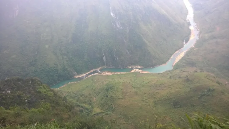
Start planning
Tell us about the journey you have in mind
Dates, party size and the places you care about are enough to start. You get a draft route and an indicative price, not a brochure.
Prefer to talk? WhatsApp or call+84 766 019 399